WWW.SCOTTLUSSIER.COM
  • Home
  • Linked In Articles
  • Teaching Portfolio
  • Passport Maps
  • Utility Mapping Portfolio
  • Non-Profit Map Portfolio
  • Power Manager Portfolio
  • Test Prep Materials
  • Printed Maps

Scott L. Lussier


Bridgewater, MA  02324                                                      Phone (617) 513-7089                                                      snlussier@gmail.com

Picture
Summary of Qualifications
  • 25 years as an Environmental Management and Geospatial Science Professional
  • 12 Years as a University Instructor
  • 15 Years of Consulting Experience
  • Expert in Geospatial Technologies
  • Professional Experience in the following industries: Power Utility Engineering, Drinking Water Compliance, State Regulatory Agency, Regional Nonprofit Coordination, Wetlands and Waterways Compliance, GIS consulting
  • TEDx Speaker
Certifications
GISP - Geographic Information System Professional, 2008 to Present. GIS Certification Institute (GISCI)

Pix4D - Passed the Pix4D Certification Exam in January of 2019 and completed the 2-day Pix4D course in Boston in June of 2018,

PMP - Project Management Professional, 2013 to 2017. Project Management Institute (PMI)

Drone Pilot - FAA Certified Part 107 Small Unmanned Aerial Vehicle (Drone) Pilot, 2016 to Present

Key Skills
  • ESRI ArcGIS 10.6 and ArcGIS Pro
  • Quantum GIS (QGIS) 3.28
  • PostGIS
  • SQL
  • ArcGIS Online
  • AutoCAD
  • PLS-CADD
  • Google Earth
  • Safe and Legal Drone /UAV  Data Collection
  • Emlid Reach RS+ RTK GPS systems
  • Trimble SketchUp
  • Microsoft Project
  • Microsoft Office (Word, Excel, PowerPoint, Access, Outlook)
  • DroneDeploy, Pix4D, MapsMadeEasy, AgiSoft PhotoMapper, Drone2Map
  • Adoe Creative Cloud (Photoshop, Lightroom, Color, Acrobat)
Education
MASTER OF SCIENCE, ENVIRONMENTAL ENGINEERING SCIENCES - UNIVERSITY OF MASSACHUSETTS LOWELL, College of Engineering, Lowell, MA - 1998

BACHELOR OF ARTS, MARINE AFFAIRS - 
UNIVERSITY OF RHODE ISLAND, Kingston, RI - 1992

Experienced Geospatial Scientist

Twenty-five years of professional accomplishments in the environmental management field. Ten years experience teaching various environmental science courses at the University level. Skilled in project management, outreach, analysis and support as Program Manager, Project Manager, GIS Specialist, Environmental Analyst and Consultant. Certified as a GISP and PMP. Drone Pilot who knows how to use the data once its captured.

Picture
Experienced Technical Educator

Scott is an instructor in the Environmental Science and Environmental Studies Programs at Suffolk University in Boston.  He has developed and taught GIS courses for both engineering majors and non-science majors.  In addition, he teaches online science courses at Suffolk and maintains the University’s GIS Laboratory and leads Suffolk's drone efforts. He also presents educational workshops for non-profit groups, professional societies, and state and federal agencies. He has also taught GIS courses at Bridgewater State University and has taught a Environmental Law course at Kaplan University.  


Geospatial Data Expertise

Scott is a Certified Geographic Information Systems Professional (GISP) with 23 years of environmental and mapping experience. Scott has worked for non-profits (NEIWPCC), state agencies (Massachusetts Department of Environmental Protection) and private consulting firms (Vanderweil Engineers) throughout these 20 years. 


Power Engineering Program Manager / GIS Manager

Scott managed numerous GIS and PLS-CADD projects for large electric utilities, including National Grid, NSTAR, Northeast Utilities, VELCO and PSNH. He overseaw approximately 30 transmission line engineering projects for National Grid, handling initial proposals, change orders, project tracking, scheduling, reporting, and closeout, including earned value management analysis.  He directed a group of four technicians in developing digital geospatial data sets for large electric providers such as National Grid, Northeast Utilities, and Vermont Electric. He regularly trained staff on use of geospatial technologies.


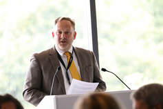
Here is the TEDx Talk I gave in February of 2016:
And a video I helped make on flying drones to study salt marsh vegetation:
Proudly powered by Weebly
  • Home
  • Linked In Articles
  • Teaching Portfolio
  • Passport Maps
  • Utility Mapping Portfolio
  • Non-Profit Map Portfolio
  • Power Manager Portfolio
  • Test Prep Materials
  • Printed Maps